Tecumseh Trail
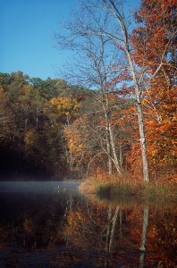
The Tecumseh Trail skirts Bear Lake
A map of the new reroute around the closure at the Indian Hill railroad crossing is available here: June 2022 Tecumseh Trail Reroute
Note that the reroute involves a one mile walk on State Road 45 from West Lost Branch Road to the Sycamore Land Trust parking lot for Trevlac Bluffs. SR 45 is a busy highway with little to no shoulder, so walk at your own risk or get a shuttle.
See the Tecumseh Trail Guide for shuttle options around this closure.
*********************************
If the HHC has a signature trail, the 42-mile Tecumseh Trail in Indiana is probably it. Built by the HHC in 1998-2002, the Tecumseh Trail begins at Morgan-Monroe State Forest Headquarters, which is about 5 miles south of Martinsville. It ends in a remote area of Brown County forest near Monroe Reservoir, just south of S.R. 46 near Crooked Creek Road.

Wild Geraniums along the trail
In terms of hills, the Tecumseh Trail is often considered a gentler version and training ground of the Knobstone Trail, a 52-mile one-way path that is further south in Indiana, near the city of Salem. While the Tecumseh’s path does consist of many large hills, ascents are not typically as steep, long, or frequent as those of the Knobstone Trail.
But the logistics of backpacking the Tecumseh can sometimes have more challenges. While the Tecumseh Trail tends to offer many opportunities for backcountry (non-potable) water sources, it often has less parking or allowable camping areas than the Knobstone Trail. This can impact the amount of miles necessary to hike in a day, and it is for this reason that all trips should be carefully planned ahead of time.
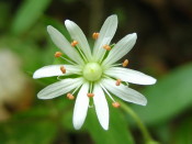
Star Chickweed blankets portions along the trail in spring
The HHC created and published the only Tecumseh Trail map which has detailed topographical information. We also denote on our map mileage markers and the areas where you can park and camp, to assist in planning your trip. You can purchase this map on our Store page.
You can also download the HHC Tecumseh Trail Guide, which provides information useful in planning a hike or backpacking trip, such as parking, access, water, and camping.
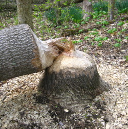
Beavers at Yellowwood keep HHC maintenance crews busy
The DNR manages the state forests on which the Tecumseh traverses. They often have available a free Tecumseh Trail map at their Yellowood State Forest Headquarters, or their Morgan-Monroe Forest Headquarters. This map provides a good overview of the trail, information on some roads, but does not have any contour lines.
Here are the GPS track coordinates of the Tecumseh Trail, in standard gpx format: Right-click here and select “Save As”.
Here are the GPS waypoint coordinates of the Tecumseh Trail Points of Interest in standard gps format: Right-click here and select “Save As”.
If your browser tries to save the file as xml, add “.gpx” to the end of the filename.
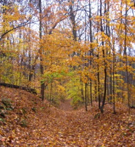
View of fall colors from Gorely Knob
If you are in need of a shuttle we are aware of one business that offers them for this trail, which is Most High Adventure Outfitters from Bloomington, Indiana.
If you would like to speak to someone experienced with the Tecumseh Trail, email or call us toll-free at 1-855-812-HIKE.